Gas station nearby TOTAL Tankstelle
Germany
Gas station nearby TOTAL Tankstelle
TOTAL Tankstelle
Prosperstraße 440, Bottrop Deutschland
contacts phone
:
+49
Latitude:
51.5221732
, Longitude:
6.9843649
read more
nearest Gas station
102 m
TOTAL Tankstelle
Am Kämpchen 106-107, Bottrop
Gas station
read more
1.554 km
Westfalen Tankstelle
Wilhelm-Tenhagen-Straße 1, Bottrop
Gas station
read more
1.694 km
Aral
Karnaper Straße 44, Essen
Gas station
read more
1.876 km
Brennstoffe Weddeling GmbH
An der Knippenburg 120, Bottrop
Gas station
read more
1.88 km
tankpool24
An der Knippenburg 120, Bottrop
Gas station
read more
2.2 km
Aral
Ostring 201, Bottrop
Gas station
read more
2.409 km
JET
Horster Straße 264, Bottrop
Gas station
read more
2.505 km
DTS NL West Dssd Für Aral AG & Co. KG
Daniel-Eckhardt-Straße 8, Essen
Gas station
read more
3.355 km
Aral Tankstelle
Horster Straße 370, Gladbeck
Gas station
read more
3.364 km
Aral
Horster Straße 370, Gladbeck
Gas station
read more
3.628 km
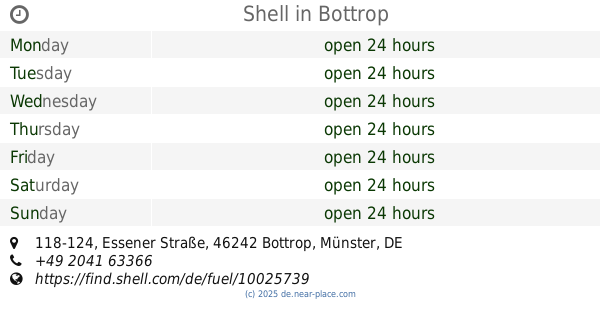
Shell
Essener Straße 118-124, Bottrop
Gas station
read more
3.946 km
JET petrol stations Germany GmbH
Kärntener Ring 64, Gelsenkirchen
Gas station
read more
4.231 km
JET Tankstelle
Bottroper Straße 306, Essen
Gas station
read more
4.775 km
Jet-Tankstelle an der B224
Gladbecker Straße 292, Essen
Gas station
read more
6.148 km
Markant Tankstelle
Horster Straße 189, Gelsenkirchen
Gas station
read more
📑
all categories
Accounting
Administrative area level 1
Administrative area level 2
Airport
Amusement park
Aquarium
Art gallery
Atm
Bakery
Bank
Bar
Beauty salon
Bicycle store
Book store
Bowling alley
Bus station
Cafe
Campground
Car dealer
Car rental
Car repair
Car wash
Casino
Cemetery
Church
City hall
Clothing store
Colloquial area
Convenience store
Country
Courthouse
Dentist
Department store
Doctor
Electrician
Electronics store
Embassy
Establishment
Finance
Fire station
Florist
Food
Funeral home
Furniture store
Gas station
General contractor
Grocery or supermarket
Gym
Hair care
Hardware store
Health
Hindu Temple
Home goods store
Hospital
Insurance agency
Jewelry store
Laundry
Lawyer
Library
Light rail station
Liquor store
Local government office
Locality
Locksmith
Lodging
Meal delivery
Meal takeaway
Mosque
Movie rental
Movie theater
Moving company
Museum
Natural feature
Neighborhood
Night club
Painter
Park
Parking
Pet store
Pharmacy
Physiotherapist
Place of worship
Plumber
Point of interest
Police
Political
Post office
Premise
Real estate agency
Restaurant
Roofing contractor
Route
Rv park, camping
School
Shoe store
Shopping mall
Spa
Stadium
Storage
Store
Subpremise
Subway station
Supermarket
Synagogue
Taxi stand
Train station
Transit station
Travel agency
University
Veterinary care
Zoo
administrative area level 3
administrative area level 4
sublocality level 1
sublocality level 2
sublocality level 3
↑