Park nearby Paul Boden Kleingartenverein Tannenbusch
Coronavirus disease (COVID-19) Situation
confirmed cases
38828995
deaths
183027
Germany
Park nearby Paul Boden Kleingartenverein Tannenbusch
Paul Boden Kleingartenverein Tannenbusch
Leichlinger Straße 38, Langenfeld (Rheinland) Niemcy
contacts phone
:
+49
Latitude:
51.11284
, Longitude:
6.9685
read more
nearest Park
503 m
Kleingartenanlage "Im Bärenbusch"
Bogenstraße 103, Langenfeld (Rheinland)
Park
read more
968 m
Further Moor
Langenfeld
Park
read more
1.631 km
Forest Jump - Sandberge (BMX, Dirt Trial-Strecke)
Am Block 4, Leichlingen (Rheinland)
Park
read more
1.862 km
Mahnmal Wenzelnberg
40764, Langenfeld (Rheinland)
Park
read more
2.438 km
Gebäudedienst Lenzen
Merlenforst 17, Leichlingen (Rheinland)
Park
read more
2.973 km
Eicherhofpark
Leichlingen
Park
read more
3.162 km
Trialpark
51379, Unnamed Road, Leverkusen
Park
read more
3.399 km
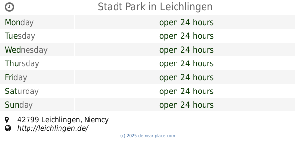
Stadt Park
Leichlingen
Park
read more
3.635 km
Wanderbrücke
Leichlingen
Park
read more
4.26 km
Vogelbeobachtungshütte Oerkhaussee
Hilden
Park
read more
4.455 km
Karnevalsgesellschaft Kniebachschiffer 1955 e.V.
Lehmkuhler Weg 12A, Hilden
Park
read more
4.495 km
Park Engelsberger Hof
Solingen
Park
read more
4.513 km
barf-alarm.de
Haus-Vorster-Straße 30, Leverkusen
Park
read more
4.705 km
Oelmühle
42699, Oelmühle, Solingen
Park
read more
4.767 km
Heinz | Garten- und Landschaftsbau MEISTERBETRIEB
Overbergstraße 10, Hilden
Park
read more
4.857 km
Wupperwiesen
Leverkusen
Park
read more
5 km
Ohligser Heide
Solingen
Park
read more
5.011 km
Wupperhang mit Henkensiepen und Hüscheider Bachtal
Leverkusen
Park
read more
5.424 km
Kath Friedhof St. Joseph Solingen
Hackhauser Straße 14, Solingen
Park
read more
5.431 km
Rennbaumplatz
Opladen
Park
read more
5.442 km
Schulgarten
An Sankt Remigius 21, Leverkusen
Park
read more
5.602 km
Wanderweg A2 Kohlsberger Höhe
Kohlsberger Höhe 11, Solingen
Park
read more
5.782 km
Bürgerwiese
Monheim am Rhein
Park
read more
5.897 km
Tillmanns Park
Leverkusen
Park
read more
6.853 km
Wiembachaue
Leverkusen
Park
read more
📑
all categories
Accounting
Administrative area level 1
Administrative area level 2
Airport
Amusement park
Aquarium
Art gallery
Atm
Bakery
Bank
Bar
Beauty salon
Bicycle store
Book store
Bowling alley
Bus station
Cafe
Campground
Car dealer
Car rental
Car repair
Car wash
Casino
Cemetery
Church
City hall
Clothing store
Colloquial area
Convenience store
Country
Courthouse
Dentist
Department store
Doctor
Electrician
Electronics store
Embassy
Establishment
Finance
Fire station
Florist
Food
Funeral home
Furniture store
Gas station
General contractor
Grocery or supermarket
Gym
Hair care
Hardware store
Health
Hindu Temple
Home goods store
Hospital
Insurance agency
Jewelry store
Laundry
Lawyer
Library
Light rail station
Liquor store
Local government office
Locality
Locksmith
Lodging
Meal delivery
Meal takeaway
Mosque
Movie rental
Movie theater
Moving company
Museum
Natural feature
Neighborhood
Night club
Painter
Park
Parking
Pet store
Pharmacy
Physiotherapist
Place of worship
Plumber
Point of interest
Police
Political
Post office
Premise
Real estate agency
Restaurant
Roofing contractor
Route
Rv park, camping
School
Shoe store
Shopping mall
Spa
Stadium
Storage
Store
Subpremise
Subway station
Supermarket
Synagogue
Taxi stand
Train station
Transit station
Travel agency
University
Veterinary care
Zoo
administrative area level 3
administrative area level 4
sublocality level 1
sublocality level 2
sublocality level 3
↑